

When people think of “The Low Country” they generally think of South Carolina, however, North Carolina has it’s own “Low Country”!
Definition of low country from Mirriam-Webster’s Dictionary: a low-lying country or region; especially : the part of a southern state extending from the seacoast inland to the fall line.
North Carolina’s Brunswick Islands ( just below Wilmington, NC, and Cape Fear) are in North Carolina, however, they lie to the south of Columbia, the capital of South Carolina!
North Carolina’s Low Country is the northernmost subtropical region on the east coast and enjoys a climate similar to that of South Carolina’s low country.
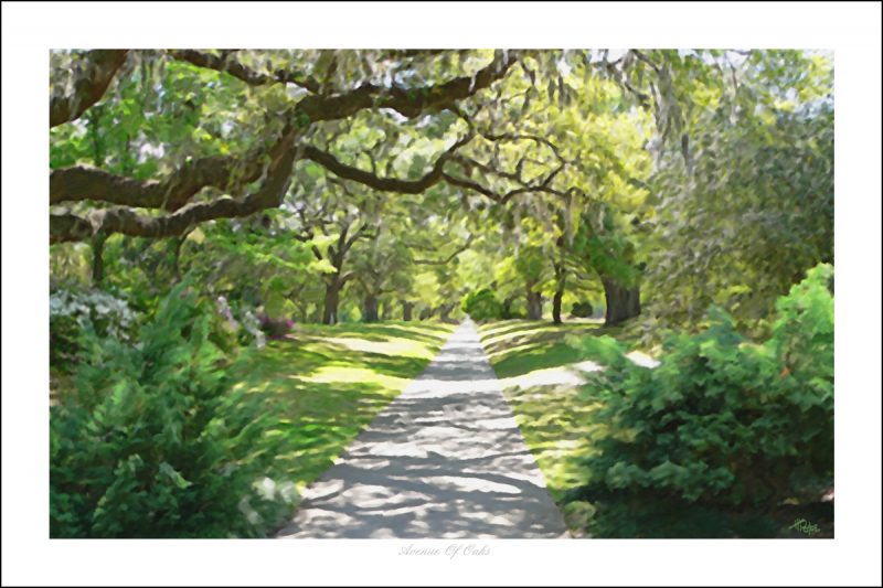
Over a dozen varieties of palm trees, hibiscus flowers, bananas, and loquat trees thrive on these islands and on the mainland, giant live oaks draped in Spanish Moss abound.
 In the prime of the rice plantation culture of the 17th and 18th centuries, this area was also home to the northernmost of these plantations.
Orton Plantation near Southport is a prime example of a North Carolina low country rice plantation.
Starting at the border with SC are Bird Island (uninhabited), Sunset Beach, Ocean Isle Beach, Oak Island and Bald Head Island (which forms Cape Fear).
This area (NC’s Low Country) was originally part of South Carolina when the two colonies split in 1729.
In 1663 Charles II of England issued a charter granting the Lords Proprietor title to all of the land from the southern border of the Colony of Virginia at 36 degrees north to 31 degrees north (along the coast of present-day Georgia).
In 1729 the Province of Carolina was divided when the descendants of seven of the eight Lords Proprietors sold their shares back to the Crown. Only the heirs of Sir George Carteret retained their original rights to what would become the Granville District. Both the Province of North Carolina and the Province of South Carolina became English Crown Colonies in 1729.
The boundary was in question while surveying teams mistakenly redrew the border more than once. The North Carolina-South Carolina border veered miles away from the course British colonial officials intended, and then effectively disappeared as the trees it was marked on died.
This map from 1737 shows a nebulous line than simply disappears as it follows a course that is roughly the current border of today.

Museum quality Giclee’ prints of the antique map shown and the print Avenue Of Oaks above can be purchased in a variety of sizes that fit standard frames by visiting our Island Life NC Store

